Equitably Reconnecting Communities

Equitably Reconnecting Communities

Equitably Reconnecting Communities

in Small and Midsize Cities

in Small and Midsize Cities

National City, California

National City, California

National City and Southeast San Diego Green Corridor

The Community Connectors project in National City, CA, focused on connecting National City and Southeast San Diego by transforming land under a divisive highway into a community park that incorporates reforestation, housing, cultural art, and community-building elements.

The
The National City community is a vibrant and diverse urban area located in San Diego County, California. The community reflects a multicultural tapestry, with residents from various racial and ethnic backgrounds. Demographics are influenced by the community’s close proximity to the US-Mexico border, which is only 15 minutes away by car and 30 minutes by trolley [1]. The demographic breakdown is 28% Black, 8% Asian, 5% White, 13% Other, and 3% Two or more races. The majority, at 56%, are Hispanic/Latino [2].


National City features a mix of residential, commercial, and industrial areas, creating a dynamic urban landscape. It includes mixed-use developments that combine residential and commercial elements. The community is also home to several schools.
The
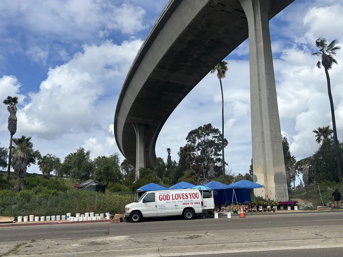
The 805 Freeway is one of many high-volume highways that cut through National City. The resulting physical barriers, traffic proximity and volume, limited access to green space, pollution, and car-centric transportation environment have harmed residents’ quality of life and well-being. I-5 divides the city from its waterfront to the west while I-805 divides the city’s east side. On I-805, developers planned on building a connection to another highway, but after community advocacy and opposition, this Toyon Freeway project was canceled. However, the exit that would have led to this never built freeway, Exit 11A still exists, abruptly leading drivers to a mall complex [3].

The

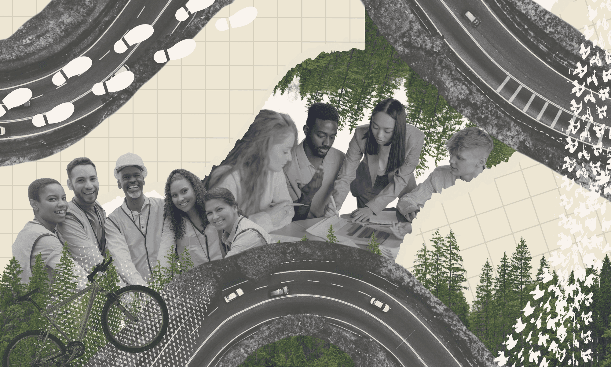
The Community Connectors project advanced the work of the National City Southeast Greenspace Corridor Project, which seeks to unify National City and Southeast San Diego by creating a community space that incorporates arts, culture, biodiversity, and social cohesion elements. That space would take the shape of a seven-acre community park that connects National City and Southeast under the 805 Freeway. This initiative, which community members have been advocating for for over two decades, seeks to preserve the natural environment, promote access to green spaces, and improve conditions that support residents’ well-being, such as safe pathways with essentials like trash cans and shade. 
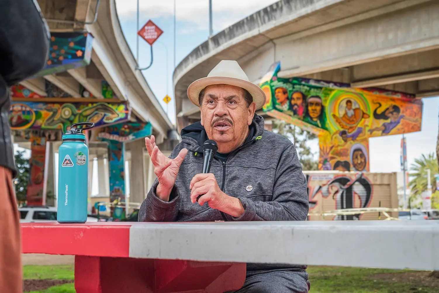
Artist Victor Ochoa shares the history of San Diego's Chicano Park, inspiring the Community Connectors team (Credit: Vito Distefano)

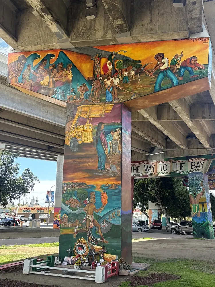
Mural depicts Chicano activists reclaiming the site now known as Chicano Park

Community Connectors team and friends gather in Chicano Park (Credit: Vito Distefano)

Site of a community garden in National City, closed due to soil contamination

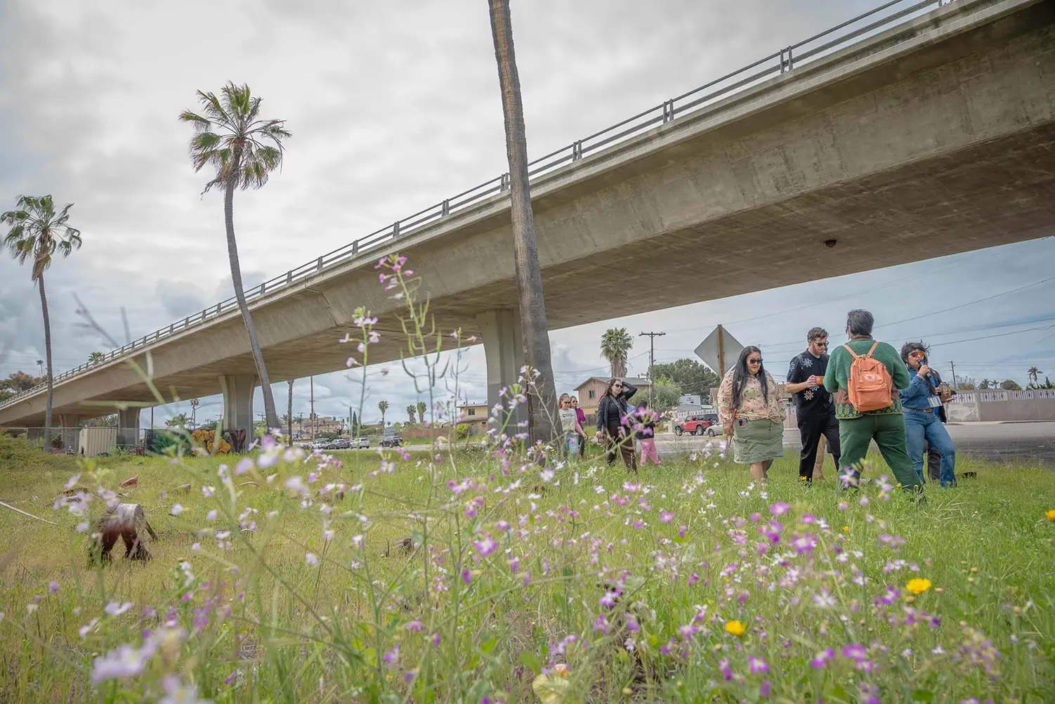
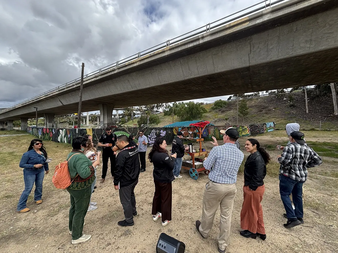
Site of the proposed park (Credit: Vito Distefano)

Martha Rodriguez, Tipey Joa Native Warriors and Kumeyaay leader, welcomes visitors to Maat Mataa Yum, "The place where people gather on the land."

Site of the proposed park

Temporary art and community conversation bring the vision for the proposed park to life

Team visits a historic site where the proposed Highway 252 was halted through organizing led by the Black Federation (Credit: Vito Distefano)

Scroll For More ➛

Artist Victor Ochoa shares the history of San Diego's Chicano Park, inspiring the Community Connectors team (Credit: Vito Distefano)

Mural depicts Chicano activists reclaiming the site now known as Chicano Park

Community Connectors team and friends gather in Chicano Park (Credit: Vito Distefano)

Site of a community garden in National City, closed due to soil contamination

Site of the proposed park (Credit: Vito Distefano)

Martha Rodriguez, Tipey Joa Native Warriors and Kumeyaay leader, welcomes visitors to Maat Mataa Yum, "The place where people gather on the land."

Site of the proposed park

Temporary art and community conversation bring the vision for the proposed park to life

Team visits a historic site where the proposed Highway 252 was halted through organizing led by the Black Federation (Credit: Vito Distefano)

Scroll For More ➛

Artist Victor Ochoa shares the history of San Diego's Chicano Park, inspiring the Community Connectors team (Credit: Vito Distefano)

Mural depicts Chicano activists reclaiming the site now known as Chicano Park

Community Connectors team and friends gather in Chicano Park (Credit: Vito Distefano)

Site of a community garden in National City, closed due to soil contamination

Site of the proposed park (Credit: Vito Distefano)

Martha Rodriguez, Tipey Joa Native Warriors and Kumeyaay leader, welcomes visitors to Maat Mataa Yum, "The place where people gather on the land."

Site of the proposed park

Temporary art and community conversation bring the vision for the proposed park to life

Team visits a historic site where the proposed Highway 252 was halted through organizing led by the Black Federation (Credit: Vito Distefano)

Scroll For More ➛

Mobility Legacies

National City, California

This city's local history offers critical context for the current circumstances and ongoing work to improve community conditions.

The following mobility legacies, organized according to mobility patterns that are prevalent across the United States, point to harmful policies and decisions, and subsequently, opportunities for repair and reconnection. They do not provide an exhaustive history of the city.

forced migrations

forced migrations

forced migrations

Industrialization & Uneven Economic Mobility

Industrialization & Uneven Economic Mobility

Industrialization & Uneven Economic Mobility

Urban Renewal & Disruption

Urban Renewal & Disruption

Urban Renewal & Disruption

Ecological and Environmental Impacts  

Public Safety

Public Safety

Public Safety

Citations

Support for this website was provided by the Robert Wood Johnson Foundation.

The views expressed here do not reflect the views of the Foundation.

Equivolve produced these City Snapshots as the learning and strategy partner for the Equitably Reconnecting Small and Midsize Cities Initiative.

Website by lover studio

Support for this website was provided by the Robert Wood Johnson Foundation.

The views expressed here do not reflect the views of the Foundation.

Equivolve produced these City Snapshots as the learning and strategy partner for the Equitably Reconnecting Small and Midsize Cities Initiative.

Website by lover studio

Support for this website was provided by the Robert Wood Johnson Foundation.

The views expressed here do not reflect the views of the Foundation.

Equivolve produced these City Snapshots as the learning and strategy partner for the Equitably Reconnecting Small and Midsize Cities Initiative.

Website by lover studio

Do you want to make your own City Snapshot? 

The Setting Your Stars Worksheet can get you started. See page 49 of The Journey Forward.